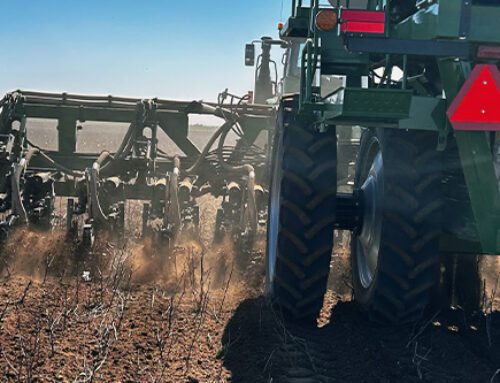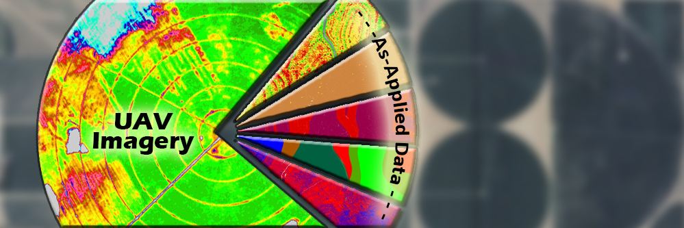
Precision Ag, drone images, UAVs and big data are terms that you will see in nearly every farm magazine available. These terms have become such popular topics that they are even showing up in main stream media outlets such as the Wall Street Journal and USA Today. Most articles portray UAVs and drones as platforms for collecting imagery, but fail to mention big data. The term big data usually represents the data (yield, as applied, machine performance, etc.) being collected by farm equipment. The reality is that imagery collected from precision ag drones will be bigger than any data collected by a monitor in a tractor.
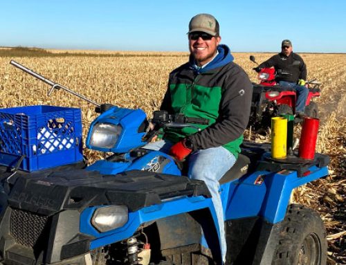
There are numerous options to choose from when collecting precision ag drone images. The options range from live video, to collecting single photos of specific points in the field. The most common option is collecting photos in succession to capture images over the entire field. These images can then be stitched together to create one image of the entire field.
Big data comes into play as soon as you start collecting any video or images. Table 1 shows data storage rates for a GoPro Hero and a Canon S100 12 megapixel camera.
Table 1) Data storage rates for two common image sources.
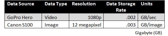
Table 2 shows a comparison of data sizes between 1 hour of field video, 1 Stitched Field Image, and 1 full growing season of yield/as-applied monitor data. As a reference, iPads have storage options of 16, 32, 64, and 128 GBs. A typical smart phone has between 16 and 64 GBs of storage.
Table 2) Approximate data sizes for a 100 acre field
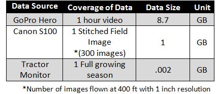
Ag drone images used for stitching are taken with about 80% overlap to insure data quality and for stitching purposes. A 100 acre field will have approximately 300 images, covering approximately 1.5 acres per image. When we compare 1 stitched field image (1 GB) to a season’s worth of as-applied data and yield data for a 100 acre field (.002 GBs), the data size for the image dwarfs that of any data collected by a tractor monitor.
The data above, shows that capturing images over numerous fields throughout the season will result in hundreds of Gigabytes of data. That data will have to be processed locally on a personal computer or sent to a data processing center. Processing the data on your local farm computer would be the preferred method for most people. Data security and self-dependency being two of the main reasons to keep the data processing on the farm. However, when you look at the cost of the software and computing power needed to process all of those images, then the thought of on farm imagery processing looks a little less appealing.
Current image processing software is limited to processing images one field at a time and takes on average a couple of hours to stitch and georeference a drone image, also known as an orthorectified image. An orthorectified image of a 100 acre field with a resolution higher than six inches can be as big as 2 GB in size. Image processing software will continue to improve making it faster and more affordable. However the amount of data will likely continue to increase as sensors become more powerful.
There are image processing companies that can take all of your precision ag drone images and process them to give you an orthorectified image. The turnaround for these types of services is usually 24 hours. They don’t have a limit on the number of fields they can process at one time, allowing you to upload a whole farm and have the data back in 24 hours or less. The restriction with uploading data to image processing companies is the upload capacity of your home internet.
Most home internet services are optimized for downloading data not uploading it. All internet packages are different, but on average the upload speed is a tenth the download speed of a typical home internet package. Internet companies also have the ability to throttle how much data someone is downloading or uploading. These restrictions could result in taking hours or days to upload data to a processing center. Most image processing companies will suggest overnighting a flash drive with all of your images to avoid any upload issues.
Precision Ag drone imagery has truly introduced big data to the farm. Before it becomes overwhelming, make sure you are set up to handle it. Imagery can be a revolutionary tool, but without being processed correctly it just becomes another “pretty picture”. Crop Quest Crop Health Imagery Services are designed to provide a network for imagery collection, processing, and delivery.